

Snowy Columbia South Carolina
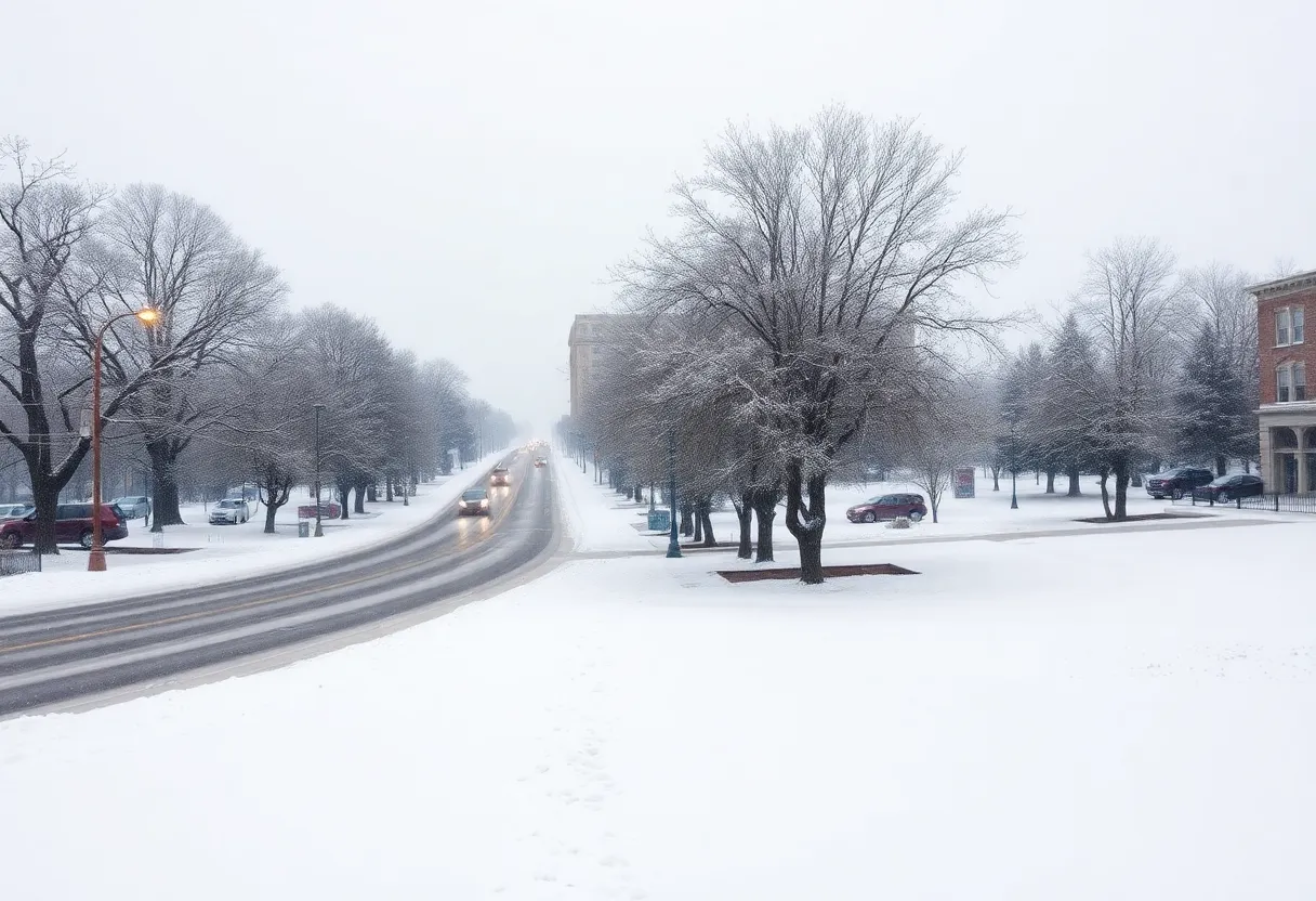
Columbia, South Carolina, is preparing for significant wintry weather over the next week, with a cold front bringing freezing temperatures and the likelihood of snow accumulation. Predictions indicate that areas may receive up to four inches of snow, leading to hazardous travel conditions. Schools are transitioning to e-learning, and city services are operating under limited schedules. Residents are advised to stay warm and be cautious on the roads as the cold weather advisory remains in effect.
Columbia and many surrounding areas in South Carolina are in for a real winter treat—well, perhaps not the kind of treat everyone was hoping for. Over the next few days, residents can expect some pretty chilly conditions, with the chance of accumulating snow turning from mere possibility to likely reality. That’s right, grab those winter coats and start preparing your hot cocoa!
A cold front is set to arrive on Sunday night and stick around for a whole week, bringing with it high temperatures barely scraping the 30s and overnight lows that might dip all the way down into the teens. That’s cold enough to make anyone want to stay indoors! To make things even chillier, wind chills could drop below 15 degrees overnight, so those who plan to venture outside should bundle up and stay warm.
The National Weather Service has indicated a strong likelihood of snowfall blanketing most parts of South Carolina, especially from Tuesday into Wednesday. With snow accumulation estimates ranging from one to three inches, some areas might see even more! A significant winter storm is predicted, especially affecting regions south of Interstate 20.
According to the latest forecasts, the Midlands, Lowcountry, and Pee Dee may experience the most severe impacts. Meanwhile, the Upstate might get a lighter dusting compared to their neighbors. By Tuesday evening, snowfall was already becoming widespread throughout central South Carolina and stretching into the Savannah River area of Georgia—snow lovers rejoice!
Travel conditions are getting dicey, with forecasts suggesting accumulations of about 1-2 inches in the western sections of Richland and Lexington counties, and around 2-3 inches in eastern regions. Even more snow, up to 3-4 inches, could blanket areas farther east towards Orangeburg and Manning.
Residents should be cautious about the potential risks this wintry mix brings, including frozen pipes and treacherous conditions for those who may not have the means to keep warm. And if you’re planning to drive, take heed! Icy and hazardous road conditions could lurk around every corner.
A cold weather advisory is in effect through Wednesday morning, with wind chill values dropping as low as 7 to 15 degrees. This means that not only will you feel that chill in the air but the roads are at risk for refreezing and the formation of black ice, especially as we move into Wednesday evening and days to follow. Some roads, like Charter House Road and Canterfield Road in Lexington County, have already seen closures due to these icy conditions, although they have since reopened.
As part of safety measures, numerous school districts across the Midlands, including Lexington, Richland, Orangeburg, Sumter, and Clarendon counties, are embracing e-learning for Wednesday due to weather concerns. Earlier this week, schools dismissed students early in anticipation of the incoming snowfall.
Residents should also be aware that Columbia city facilities will operate on limited schedules through Wednesday as the city opens its overflow shelter to support those without adequate housing. Additionally, the COMET public transportation system will suspend service until at least 10 a.m. on Wednesday.
After this round of wintry weather, temperatures are expected to warm up slightly, with highs nearing 40 degrees, though overnight lows may still lead to icy situations. People should remain cautious of slippery sidewalks, stairs, and untreated roadways.
As for future forecasts, keep an eye on Sunday night, as a potential storm is on the horizon again—although this time, it’s likely to be more rain than snow. So, get your winter gear ready, stay safe out there, and enjoy the snowy vibes!
News Summary South Carolina faces a challenging week with wildfires raging, particularly in the Carolina…
News Summary Residents of Columbia and Lexington Counties are being urged to prepare for severe…
News Summary On March 7, 2025, Columbia, South Carolina, witnessed its first execution by firing…
News Summary A peaceful community in Horry County was shaken by a shooting incident that…
News Summary Rusty Harris has transitioned from Enbridge Gas North Carolina to lead Enbridge Gas…
News Summary On January 30, 2025, the South Carolina Manufacturers Alliance launched the 2025 Vision,…


